
In April 2021, just a week before Anna and I met, I visited Shenandoah for the first time with my brother and a couple of friends. On our way home, we stopped for lunch somewhere in Virginia and started talking about national parks such as how many there are and what it would be like to visit them all. At that lunch table, there was no way I thought Shenandoah would be the start of a new obsession.
A year later, we went back and this time, Anna was there too. Four years have passed since that second trip in 2022 and Anna and I have had the opportunity to see 26 national parks as of the writing of this post. It all started with a trip to Shenandoah so it feels right that this is the first official post on our blog.
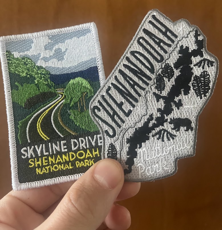
Home to the iconic Skyline Drive, Shenandoah National Park is located in the Blue Ridge Mountains of Virginia and is just about 70 miles west of Washington DC. The park is made up of the Northern, Central and Southern Districts with four main entrances (more on that later). Black bears, deer and even bald eagles are just some of the wildlife that can be spotted here if you’re lucky enough. From diverse hiking options to scenic driving, there is something in this park for everyone.
The goal of this post, and every future national park post, is to serve as a helpful resource for anyone interested in experiencing these incredible natural wonders. I’ll be sharing important information such as nearby airports and lodging options along with our favorite hikes and activities from our visit. I’ll also provide some other popular spots that we haven’t had the chance to explore. I hope everyone enjoys reading this as much as I enjoyed reminiscing about our first national park!
Need-to-know Information
Before diving into the fun stuff, let’s go over some important information about the park and the surround areas.
Fees
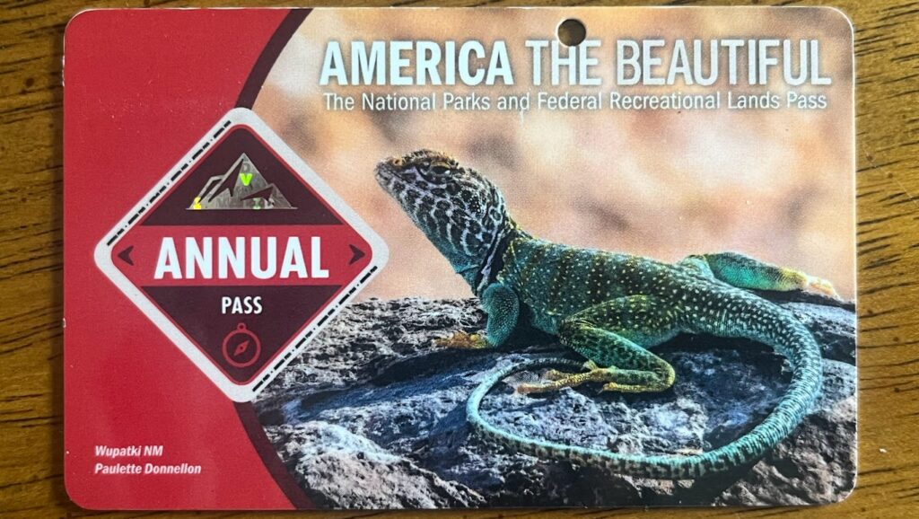
Visiting most national parks is not free (there are some that are) but luckily, the cost isn’t too much. For vehicles, the entrance fee is $30 and is good for seven days. This covers everyone that is in the car so only one pass is needed. For a motorcycle, the fee is $25. If you’re an individual without a vehicle, such as someone that wants to bike Skyline Drive, the fee will be $15. My favorite option, one that we buy every year, is the Interagency Pass. This will cost you $80 but is good for a year and gets you access to over 2,000 recreation areas managed by the Federal government. If you’re planning on visiting multiple parks in one year, this pays for itself pretty quickly. It can be purchased from the USGS Store and usually takes a few weeks to come via mail.
Airports
If you’re visiting from further distances where you’ll need to fly to the area, there are four airports within a close distance to the four entrances. To the east of the park, near Washington DC, you have Dulles International Airport (IAD) and Ronald Reagan Washington National Airport (DCA). Both offer convenient access to Shenandoah’s northern entrances. Further south near Charlottesville, you have the Charlottesville-Albermarle (CHO) airport which gets you within about a 40 minute drive to the southernmost entrance. The last option is the Shenandoah Valley Regional Airport (SHD) which will be right in between the two southernmost entrances.
Car Rental
Like most of the national parks, you will need some sort of transportation to get around. All of the airports have plenty of rental car agencies to choose from such as Avis, Budget, Sixt, Hertz, Enterprise and some others so you’ll have exactly what you need to get from place to place easily.
Places to Stay
Shenandoah is a long and narrow park, meaning there are a lot of different options for places you can stay depending on what you are looking for. If you want the big city experience, Washington DC would be your best option. Just about 90 minutes from the northern entrance, it’s totally possible to stay there and take day trips to the park. You’ll also have many options for lodging and food.
Another fun city to stay in would be Charlottesville, VA. Only about a 30 minute drive from the southern entrance, it has a nice downtown with plenty of restaurants, bars and shops. The University of Virginia is also there so if you enjoy walking around college campuses, that’s something you can do as well.
To the west of the park, you’ll find Luray, VA. Within about 20 minutes, you can be driving along Skyline Drive. While a much smaller city compared to the previous options, you get easy access to the park as well as a walkable downtown with shops and restaurants. It’s also home to the Luray Caverns, a popular spot we haven’t visited yet but always talk about checking out.
Finally, further South, you’ll find Harrisonburg, VA. Comparable in size to Charlottesville, Harrisonburg will get you to the central part of Skyline Drive. It’s another college town being the home to James Madison University, so you’ll also have an opportunity to walk around a college campus if that is of interest to you.
There are also some lodging options within the park. You can find the Skyland Lodge, Big Meadows Lodge, Lewis Mountain Cabins and Public Use Cabins on park property.
All of these airports, cities and lodges can be referenced from the map above.
Campgrounds
One last topic on places to stay would be the campgrounds within the park. We haven’t ventured into camping as of yet but I want to mention the options you have within park boundaries if that is something you like to do. Mathews Arm Campground (mile 22.1), Big Meadows Campground (mile 51.2), Lewis Mountain Campground (mile 57.5) and Loft Mountain Campground (mile 79.5) are your four options to choose from.
Must-do adventures
Skyline Drive

At long last, let’s get to our favorite parts of Shenandoah.
Arguably the best part of the park, and what Shenandoah is known best for, Skyline Drive is the 105 mile road that runs through the Blue Ridge Mountains from the northern entrance to the southern entrance.
I’ve been referencing the park entrances quite a bit so let’s finally talk about them. There are four ways to enter Skyline Drive, making the park easily accessible no matter which direction you’re coming from.
Starting at the northern end is the Front Royal Entrance. Located at mile 0 of Skyline Drive, you can access this entrance from Front Royal, VA.
Continuing south near mile 31.5, you’ll find the Thornton Gap entrance. This would the easiest entrance if you’re coming from Luray. If you’re coming from the Washington DC area, either of these first two entrances would work for you.
Down to mile 65.5 is the Swift Gap entrance near Elkton, VA. This would be the local entrance if you’re coming from Harrisonburg. Finally, the southernmost entrance at mile 104.6 near Waynesboro, VA, is the Rockfish Gap Entrance.
*If you want to continue scenic driving, keep going south out of the Rockfish Gap entrance as Skyline Drive connects with the Blue Ridge Parkway. This will take you down through the Appalachian Mountains towards North Carolina.

With 75 scenic overlooks, you’ll have plenty of amazing opportunities to fully take in the incredible views of the Blue Ridge Mountains and Shenandoah Valley. We’ve only driven this road in April before all of the trees started to bloom so we are planning to make the trip back down there one year either later in the Spring or in the Fall for peak foliage season (when all the crowds will be there 🙁). Along Skyline Drive, you can also find campgrounds, dining, lodging, gift shops and most of the trailheads.
When visiting Shenandoah, make sure you plan time for driving Skyline Drive as it’s an absolute must! Whether you drive the entire way or just do a small portion, any amount of driving on it is worth it.

Now let’s talk about the incredible hiking.
From rock scrambling to chasing waterfalls, there are all kinds of trails in this park and I’m going to highlight some of our favorites and other popular options that we have not had the chance to do yet.
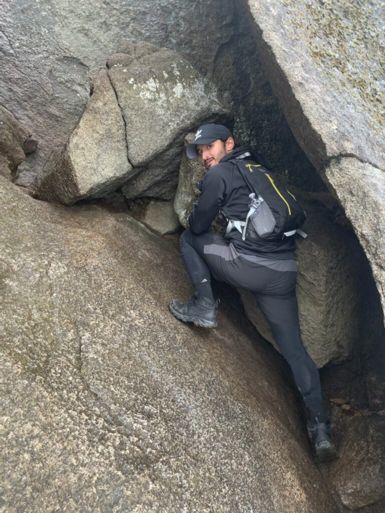
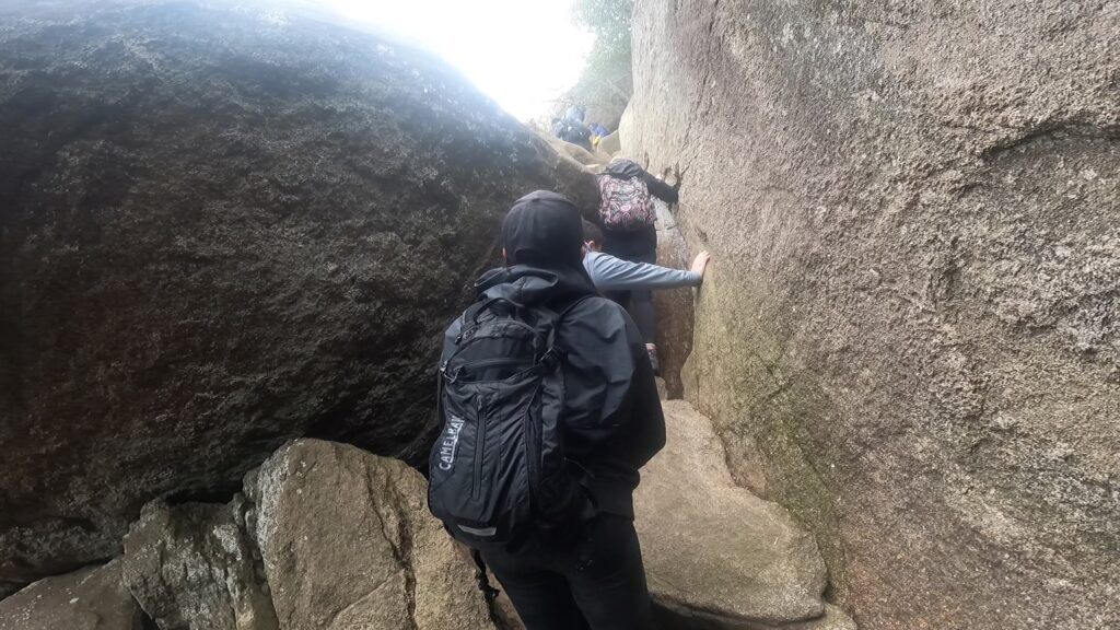
Scrambling up Old Rag


Looking for a challenging hike with a rewarding rock scramble and incredible view at the end? Old Rag has exactly that. One of our favorite hikes we’ve done in any park, there are a few ways to get to the top of Old Rag but we would highly recommend following the Mountain Loop trail. This challenging 9.5 mile loop features about 2,600 feet of elevation gain and takes you up to the scramble via the Ridge Trail, before descending along the Saddle Trail and a fire road.
As of our last visit in April 2022, there are two parking lots, so finding a spot should not be an issue. There are restrooms and a ranger station for purchasing a park pass if you don’t already have one. In addition to the park pass, a $2 day use ticket is needed from March to November and can be purchased online from Recreation.gov. More info about the day use ticket can be found at the NPS site. This system was put in place to helps manage crowd sizes during peak seasons, something many of the more popular parks have done.
I’ve hiked this trail twice, while Anna has done it once. The first time was covered in clouds so there were no views at the end but the trek up was still just as awesome as it is on a clear day. For this reason, I rate this hike very highly. One safety warning to keep in mind is if it’s raining or has rained recently, the rocks will be very slippery, so I’d encourage wearing hiking boots or trail runners with good grip. My brother came along both times and was wearing running sneakers the first time which were not ideal in the wet conditions. He was slipping on many of the rocks but he did make it up in one piece! I was wearing Columbia hiking boots which served me just fine.
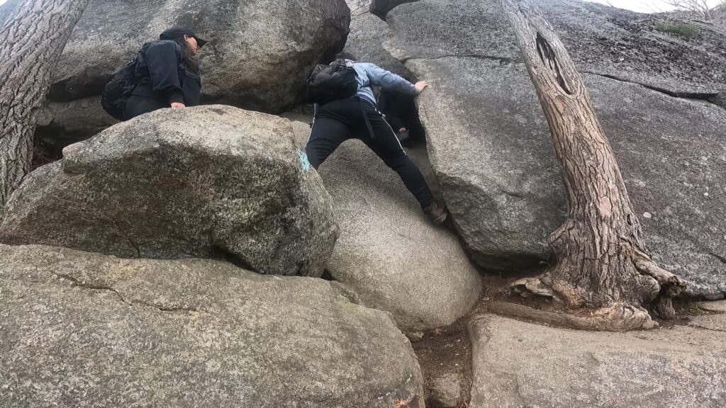
Another important safety note about the rock scramble: upper body strength will be required at certain parts of the scramble and there are some steep step-downs that you’ll want to take slowly. Anna (5 ‘1) was able to manage pretty well overall but did need some help at some sections. There are also sections that will require you to bend down or fit in tight spaces so if you have bad knees or a bad back (like me!), be prepared for those kinds of movements.
Now that we’ve covered those safety notes, let’s scramble! As I previously mentioned, this is one of our favorite hikes because of this scramble. It’s an epic part of the trail and I promise you won’t regret challenging yourself to complete it. Take your time and have fun with it as it will be different than a lot of other hikes.

One final note on Old Rag: there are a lot of false summits on the way up. Until you see the summit sign, keep going!

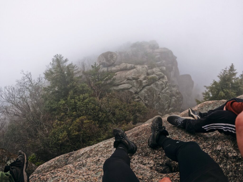
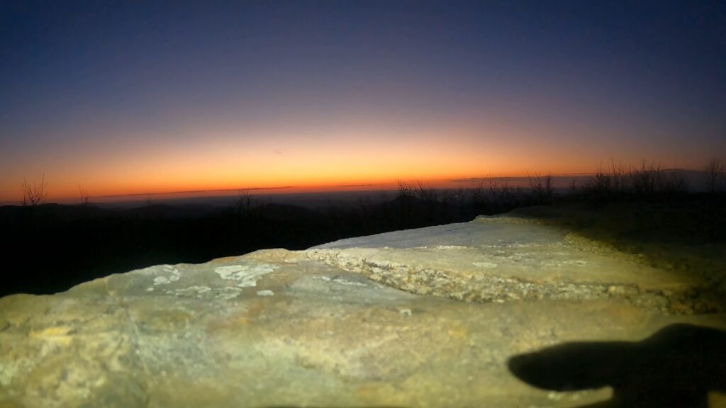
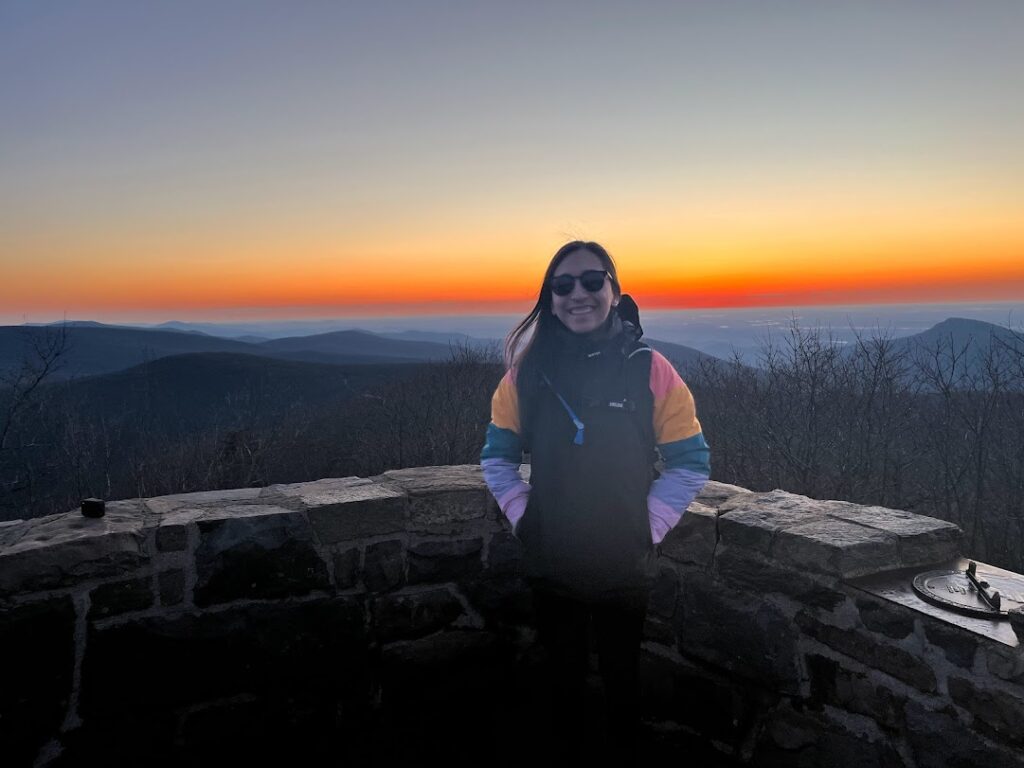
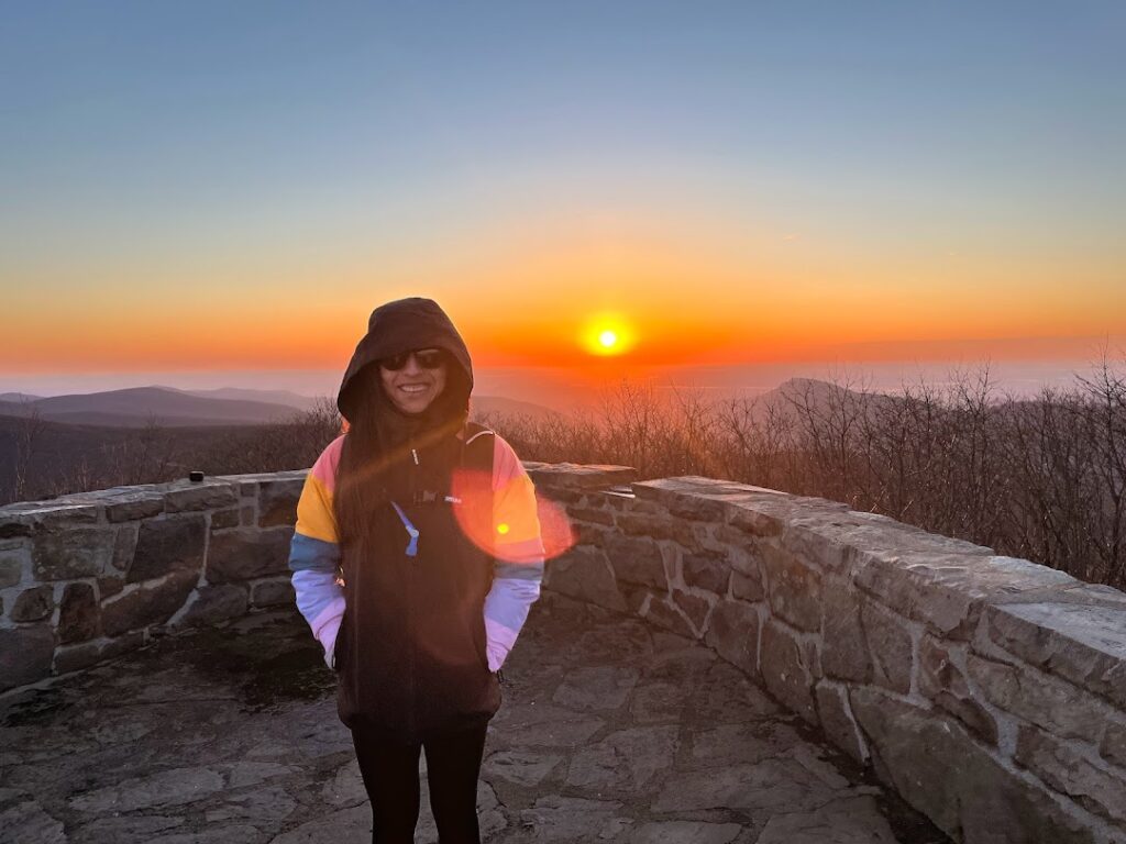
Wake up at 4am for a sunrise at Hawksbill Mountain!
What better place to watch the sunrise than at the highest peak in the park? That’s exactly what we decided to do and besides it being a very cold, early April morning, this was an experience we would highly recommend doing during your time at Shenandoah.
There are a few popular options for getting to peak:
Option 1:
On this loop, these are the trails you’ll follow:
Lower Hawksbill Trail → Viewpoint → Upper Hawksbill Trail→ Salamander Trail → Appalachian Trail
If you want to hike a part of the Appalachian Trail, this would be the trail for you to do! We did not do this trail as we opted for the Summit Trail in Option 2.
Option 2:
This out and back trail, accessible from Skyline Drive, is about a mile shorter than the loop trail. The trail is short but very steep with almost 700 feet of elevation gain. You’ll hike up the Lower Hawksbill trail and go back down the same way.
This is the option we chose for our sunrise hike. Headlamps/flashlights are an absolute necessity if hiking this for sunrise, unless you don’t mind complete darkness. We left our Airbnb around 4:30 am with about an hour drive to the parking lot at the trailhead. At 5:30 am, we had no issues parking but we can’t speak for how the lot is later in the day. As with most national parks though, the earlier you get there, the more likely you are to find parking.
You’ll know you’re at the summit as there is a stone overlook. After about a 35-40 minute hike to the top, we just sat back in the freezing cold temps and waited for that sun to rise! It was a very clear morning thankfully and the sunrise was incredible!
Option 3:
You can also choose to park at the Upper Hawksbill trailhead and follow this trail to the summit. This would be an out-and-back as well and is about 2 miles round trip with 500 feet of elevation gain.
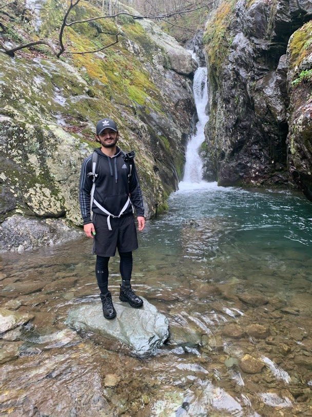
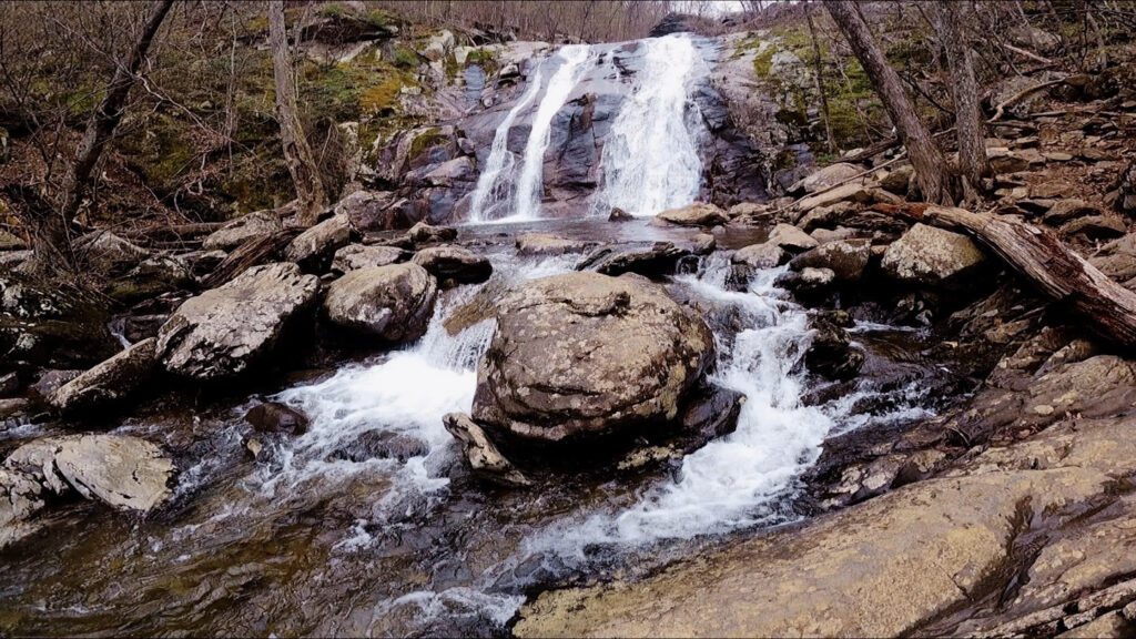
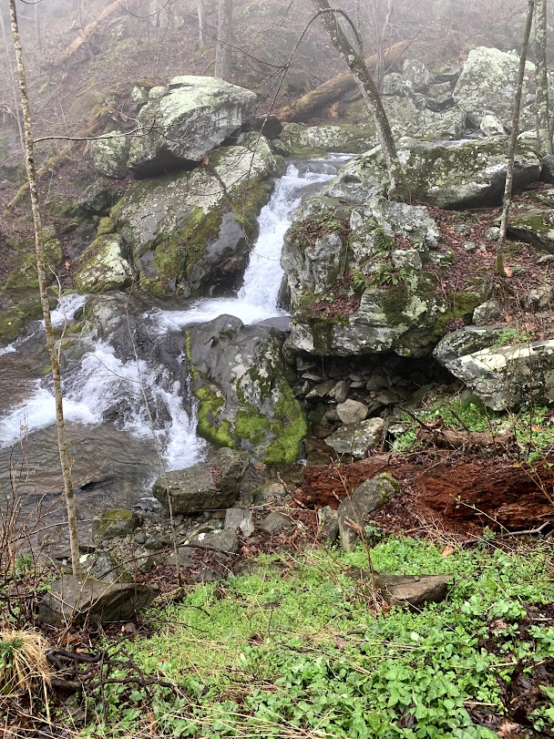
Finally, let’s go chasing waterfalls at Whiteoak Canyon/Cedar Run
If you’re a fan of waterfalls, this loop is one to consider. At 8.5 miles and over 2,300 feet of elevation gain, there are plenty of stops for waterfalls. Some big, some small as well as one you can slide down if you’re up for it. This can be a challenging hike depending on your fitness level and which direction you go in. Especially if you’re doing it the day after Old Rag! That said, getting up close to the waterfalls is as fun as it gets and if it’s warm enough, go for a swim!
The ideal way to follow this trail would be:
Whiteoak Canyon Trail → Skyland Big Meadows Horse Trail → Cedar Run Trail
We decided to do the opposite of that and while I won’t say it was a mistake, it definitely made for a harder workout than anticipated. The Cedar Run Trail is steeper so going up that instead of down was definitely more challenging. Either way, there are waterfalls on both sides offering plenty of chances to take a break!
Alternative Hikes
With all that being said, here are a few other popular hiking options for trails that are rated easy/moderate that we plan to do next time we can get down to Shenandoah.
Dark Hollow Falls Trail – 1.6 miles
Stony Man via Appalachian Trail – 1.5 miles
Bearfence Mountain Trail – 1 mile
Closing thoughts
Shenandoah will always have a special place in our hearts with it being our first national park. All of the experiences we’ve had from Skyline Drive to Old Rag have made for some great memories and the accessibility of it makes it a great park for anyone to enjoy. There’s so much more that we want to see in this park and we can’t wait to be able to get back to Virginia to do so. We hope this helps when planning your trip to Shenandoah and thanks for reading our first official blog post!