
Back in June of 2023, we decided to go on a month long, work-from-home road trip through the southwest, starting in Tucson, Arizona. On this trip, we visited four states and nine national parks and Saguaro National Park was our first stop.
A little background on how we made this trip work: we only took three days off from work and adjusted our schedule to work East Coast hours. While in Arizona, we worked from 6am to around 2:30pm, which left us plenty of time in the afternoons and evenings to explore the parks. We spent two days in Saguaro, which felt just right for us. Unless you’re planning to venture deep into the backcountry, we found this to be the perfect amount of time, especially with a busy month of travel ahead. We will be creating another post with the complete details of this road trip.
About the Park
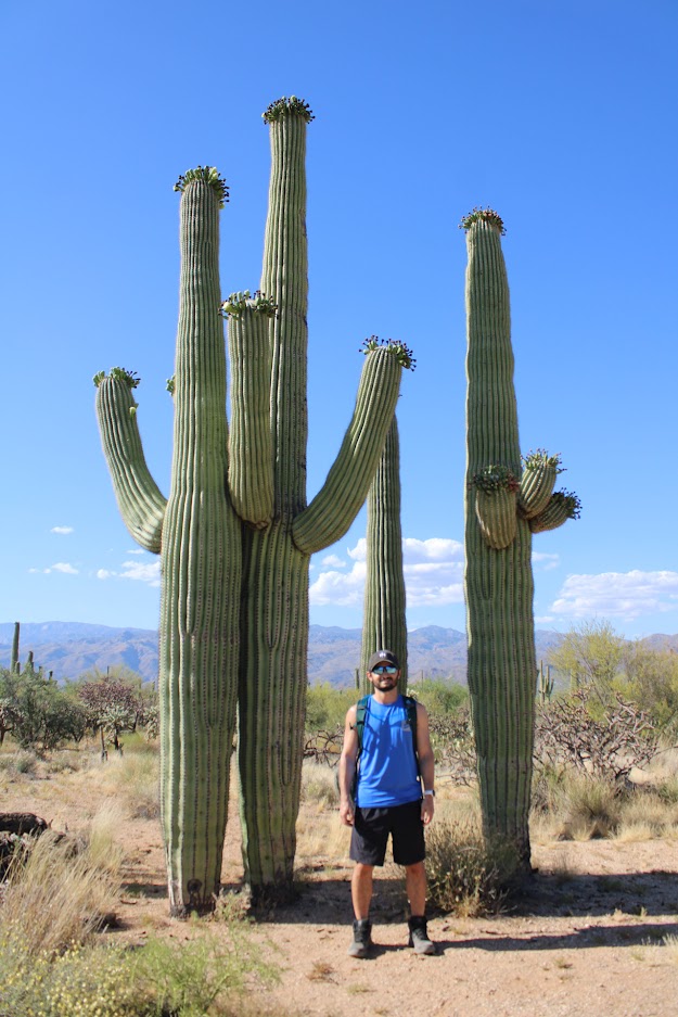
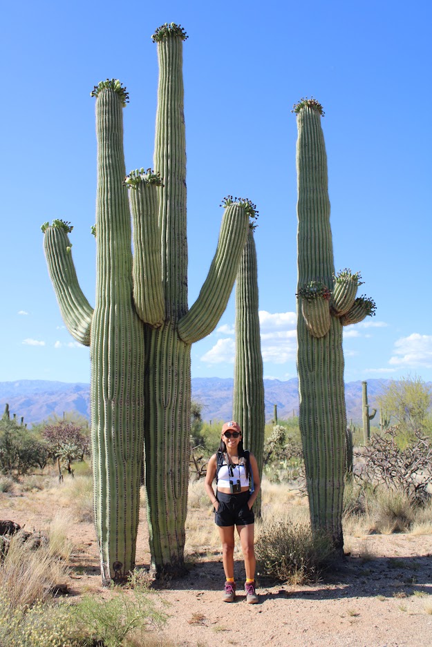
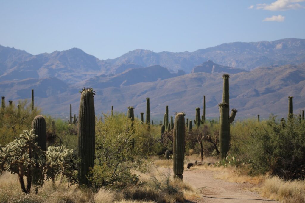
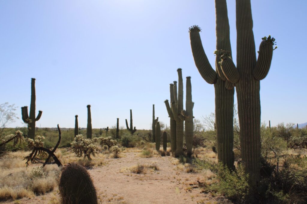
Saguaro National Park is located in the Sonoran Desert and is divided into two districts, the Tucson Mountain District to the west and the Rincon Mountain District to the east, split by the city of Tucson. The park is home to the largest cactus in the United States, the Saguaro Cactus. Found only in the Sonoran Desert, these cacti can grow up to 50 feet and live on average of 150 to 175 years! Despite its close proximity to the city, Saguaro National Park is recognized as an Urban Night Sky Place by the International Dark Sky Association, offering visitors the chance to go stargazing.
Need-to-know Information
Fees
For vehicles, the entrance fee is $25 and for motorcyles, it’s $20. For individuals without a vehicle, the fee is $15. The annual pass for access to only Saguaro is $45. Finally, as always, the interagency pass can also be used here and is $80.
Airports/Rental Cars
Flying into the area is easy, with Tucson International Airport (TUS) right in South Tucson. It offers convenient access to both districts of the park and is the airport we chose to use. There is also the Marana Regional Airport, located northwest of Tucson, which is a bit closer to the Tucson Mountain District.
For car rentals, Marana has Enterprise and Hertz to choose from while Tucson has a much wider selection including Alamo, Avis, Budget, Dollar, Enterprise, Hertz, National and Sixt. We ended up renting a Toyota Camry from Alamo and had a great experience overall with a smooth pickup and no issues. We didn’t do much offroading on this trip and I wouldn’t recommend this or similar cars for anyone that is planning to do so.
Places to Stay
With the park being split into two districts, Tucson is the perfect place to stay when visiting. We found a very cozy Airbnb in the Catalina Foothills, located in the northeastern part of the city. From there, it was just about a 45 minute drive to the Tucson Mountain District and about 30-35 minutes to the Rincon Mountain District; ideal for exploring both areas without having to switch accommodations.
There is no lodging within the park. There are, however, camping options in the Saguaro Wilderness. These are the only campgrounds in the park and can be found in the Rincon Mountains. Reservations are required and can be purchased from Recreation.gov.
Tucson Mountain District
Bajada Loop Drive
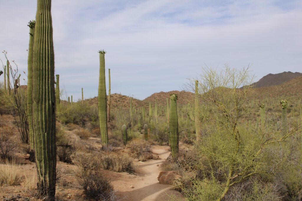
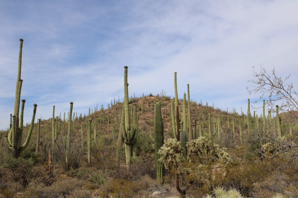
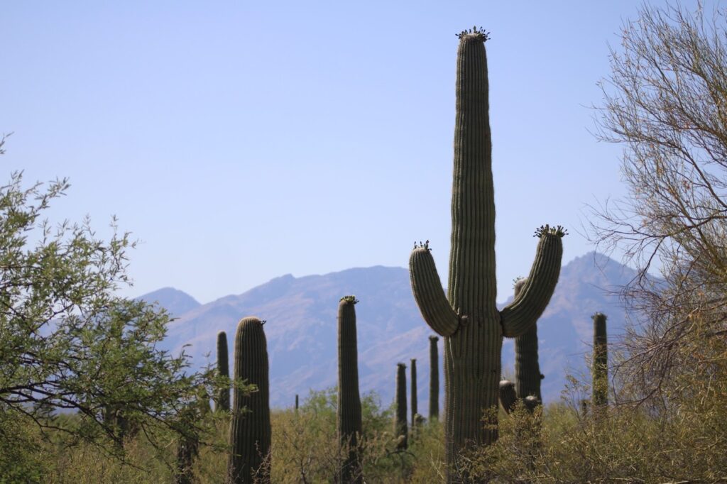
Whether you’re short on time and want a scenic overview of the park or you have some free time in between longer hikes you’re planning, the Bajada Loop Drive is one of the two loops that are absolutely worth the drive. Coming in at six miles, you’ll get a full understanding of what Saguaro National Park has to offer being surrounded by thousands of saguaros and getting glimpes of ancient petroglyphs. Basically, it’ll feel like you’re in a desert forest.
Just down the road from the Red Hills Visitor Center, you’ll pass the Desert Discovery Nature Trail on the left before taking the first right on Hohokam Road to officially start the loop. Hohokam Road provides access to a variety of hiking trails, some of which stay within the loop, while others lead deeper into the wilderness but more on those trails later! After about two miles on Hohokam, you’ll reach the end, where you’ll turn left on Golden Gate Road. From there, you’ll follow Golden Gate for the remaining three miles until you hit Sandario Road. While on Golden Gate, be sure to stop by the Signal Hill Picnic Area, which is accessible by car.
Go slow, take your time and enjoy the ride! There are plenty of pullouts and picnic tables along the loop for a more relaxing experience as well.

Hiking along the Bajada Loop
Looking for a little bit more than pullouts and picnic tables? Well there are plenty of trailheads along the loop that lead in all different directions. Whether you want to stick close to the road for a short walk or spend the afternoon hiking deeper into the park, there’s something for everyone. Also, keep in mind that most trails are exposed to the sun so it is very important to have sun screen and lots of water.
Now let’s take a look at some of the options:
Bajada Wash Trail
The Bajada Wash Trail runs along most of Hohokam Road with three different access points. When you first get on Hohokam Road, take the first left to reach the Sus Picnic Area, which gives you access to the trail’s start (or end). If you keep driving a little further down the road, you’ll reach the Valley View Overlook Trailhead, which intersects with the Bajada Wash Trail, giving you a second chance to hop on. Finally, near the end of Hohokam, you’ll find a third access point, allowing you to hike back the way you came.
Valley View Overlook Trail
This trail is short, easy and offers you a close-up view of the saguaros from start to finish. At the end, you’ll get a stunning view of desert. This trail also connects to the Wild Dog Trail, giving you the option to go a little further.

Wild Dog Trail
Accessed from the Valley View Overlook Trail, this connects Hohokam Road to Golden Gate Road right across from the Signal Hill area. Only two miles in length, this is another easy trail within the loop.
Signal Hill Trail
For another short and easy hike, the Signal Hill Trail offers one of the best opportunities to view the ancient petroglyphs up close. This is a must do hike if you have any interest in history. Would you believe we don’t have any photos of these petroglyphs…🤦♂️
Hugh Norris Trailhead
For those looking to explore deeper into Saguaro’s backcountry, the Hugh Norris Trail is a perfect chance to do so. Starting from Hohokam Road, this challenging nine mile trail with a 2,400-foot elevation gain will take you to the summit of Wasson Peak, the highest peak in the Tucson Mountain District. You’ll also be able to access the Sendero Esperanza Trail along the way. Being short on time, we opted to skip this one, but it’s definitely on our list if we’re ever back in the Tucson area.
Rincon Mountain District
Cactus Forest Loop Drive
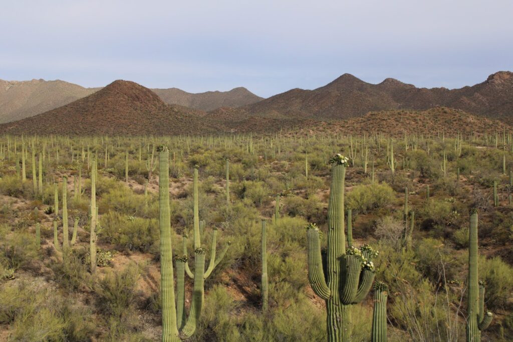
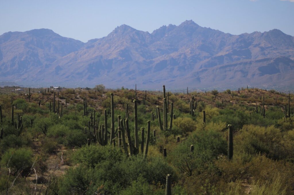
Similar to the Tucson Mountain District, the Rincon Mountains also offer a scenic loop drive. Just past the Rincon Mountain Visitor Center, you’ll see a sign for the Cactus Forest Loop Drive marking the start of the eight mile loop. On the east side, the saguaros are much more spread out compared to the west side, creating a different landscape. Despite this, the saguaros and surrounding mountain views felt more impressive. The Rincon Mountains are home to the highest peak in Saguaro National Park, Mica Mountain (8,664 ft).
Hiking Along the Cactus Forest Loop
Just like the Bajada Loop, the Cactus Forest Loop offers several trails that either stay within the loop or lead to other spots in the park
Mica View Trail
Although it’s technically outside the loop, this trail is easily accessible from the Cactus Forest Loop Drive. Just take Mica View Road, which will lead you to the trailhead and the Mica View Picnic Area. The trail itself isn’t very challenging, making it feel more like a leisurely walk in the park but instead of trees, there were humongous saguaros.
Cactus Forest Trail
Running right through the middle of the Cactus Forest Loop, the trail is accessible from various points along the loop. There will be views of the surrounding desert and the Rincon Mountains almost the entire time. This is a ten mile trail if you include the portions that extend outstide of the loop.
Tanque Verde Ridge Trail
Located close to the end of the loop, this is a long trail that leads to Tanque Verde Peak. This trail eventually connects with the Cow Head Saddle Trail which takes you to the highest peak, Mica Mountain.
Closing Thoughts
Saguaro National Park is unlike any park we had visited before. Towering saguaros and two different mountain ranges offering incredible views makes it completely worth the trip to southern Arizona. While the above trails are ones along the two scenic loops, there are over 165 miles of trails to choose from so be sure to check with park rangers for any of their recommendations.
Looking back, if we could do anything differently during our two days, it would be to fit both scenic loops into the same day so that we would have time the other day to explore further into the park’s backcountry. Even with that, we really enjoyed everything about our two days here and if you find yourself in the Tucson area or are looking for somewhere to go, Saguaro National Park should be on your radar!